ELEC-E4230 - Microwave Earth observation instrumentation D, Lecture, 13.9.2021-16.12.2021
This course space end date is set to 16.12.2021 Search Courses: ELEC-E4230
Topic outline
-
Objective of the course
Earth Observation Instrumentation course gives deep overview of latest microwave remote sensing instrumentation and advanced imaging techniques, which are used to map our home planet. Copernicus Sentinel radars, ICEYE radars, ESA radiometers, we will handle them all.
After taking the course, the student will be able to work with microwave satellite data. Download the data, preprocess, do SAR interferometry and simple polarimetry.

Content
- Microwave emission and scattering
- Natural targets
- Radiometer,
- Scatterometer, Radar, Synthetic Aperture Radar
- Imaging concepts: Polarimetry, Interferometry
- SAR techniques, image processing and interpretation
- Future concepts and small satellite instruments
Course textbook
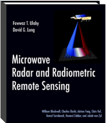
The course is partly based on, and we recommend the wonderful book by Fawwaz T. Ulaby and David G. Long, "MICROWAVE RADAR AND RADIOMETRIC REMOTE SENSING". The book has also rich selection of background material available at: http://mrs.eecs.umich.edu/start_here.html
Aalto University students can read the electronic copy of the book HERE.
Assessment
Assessment of the course comprises of workshop and homework assessment, lecture participation and a written examination (to be updated in the beginning of the course)
Lecturers
Jaan Praks
Assistant Professor
jaan.praks@aalto.fi
Room: 2153 (TUAS)
Phone:+358504205847
-
EXAMINATION 16.12.2021 10:15-1200 Assignment
-
EXAMINATION 14.1.2022 12:15-14:00 Assignment

