ELEC-E4230 - Microwave Earth observation instrumentation D, Lecture, 4.9.2023-7.12.2023
This course space end date is set to 07.12.2023 Search Courses: ELEC-E4230
Topic outline
-
Teams link to online lectures.
(The primary contact teaching form is on-site lecture. However, I will do my best to broadcast, record and distribute lecture videos. The course can be completed remotely.)
EXAM 19.10.2023 10:15 - 11:45 (Radiometers) (Online examination, quiz type, all material allowed, during given timeslot)
EXAM 7.12.2023 10:15 - 11:45 (Radar) (Online examination, quiz type, all material allowed, during given timeslot)
EXAM 26.1.2024 10:30 - 13:30 (Radar) (Online examination, quiz type, all material allowed, during given 90 min timeslot)
Objective of the course
Space is increasingly important vantage point which provides overview of planetary scale processes. Much of the remote sensing is done by using microwave instruments, radars and radiometers. This Earth Observation Instrumentation course gives detailed overview of latest microwave remote sensing instrumentation and advanced imaging techniques, which are used to map our home planet. Main focus is on spaceborne instruments and data provided by satellites, such as Copernicus Sentinel 1, TanDEM-X, ICEYE radars and SMOS radiometer.
After taking the course, the student will be able to work with microwave satellite data. Download the data, preprocess, apply SAR interferometry and simple polarimetry techniques and interpret the results.

Content of the course
- Basics of microwave imaging and theoretical background
- Electromagnetic radiation in microwave region. Pro
- Remote sensing with microwave radiometers, spaceborne and groundborne.
- Microwave emission and absorption
- Properties of natural targets
- Types of radiometers, radiometer technology
- Radiometer applications
- Remote sensing with spaceborne and airborne radars
- Scattering and reflection of electromagnetic waves.
- Scatterometer, Radar, Synthetic Aperture Radar (SAR)
- Imaging techniques: Polarimetry, Interferometry
- SAR mage processing and interpretation
- Future concepts and small satellite instruments
- Microwave remote sensing in climate change monitoring
Teaching
The course consists of weekly lectures and weekly homeworks.
Assessment
Assessment of the course comprises of workshop and homework assessment, and online examination (to be updated in the beginning of the course).
Course textbook
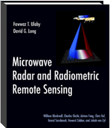
The course is partly based on, and we recommend the wonderful book by Fawwaz T. Ulaby and David G. Long, "MICROWAVE RADAR AND RADIOMETRIC REMOTE SENSING". The book has also rich selection of background material available at: http://mrs.eecs.umich.edu/start_here.html
Aalto University students can read the electronic copy of the book HERE.
Main teacher
Jaan Praks
Associate Professor
jaan.praks@aalto.fi
Room: 2153 (TUAS)
Phone:+358504205847Link to last year course

